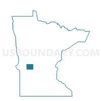
Starbuck Voting District, Pope County, Minnesota
About
Outline

Summary
| Unique Area Identifier | 603772 |
| Name | Starbuck Voting District |
| County | Pope County |
| State | Minnesota |
| Area (square miles) | 1.57 |
| Land Area (square miles) | 1.57 |
| Water Area (square miles) | 0.00 |
| % of Land Area | 100.00 |
| % of Water Area | 0.00 |
| Latitude of the Internal Point | 45.61203700 |
| Longtitude of the Internal Point | -95.53331280 |
Maps


Graphs
Select a template below for downloading or customizing gragh for Starbuck Voting District, Pope County, Minnesota